Richards Bay to Cape Town: 850 Miles I'm Planning as Five Short Hops
A southwest gale against a four-knot current is the one thing on our Cape route I can't plan around, only stay out of. Here's how I'm cutting the coast into hops.
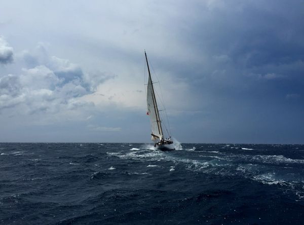
The Agulhas Current can run at four knots, sometimes a little more, along the edge of the South African shelf. A southwest gale blowing 35 knots into that current stacks the sea into steep, short, occasionally breaking walls, and the coast has a long, grim record of ships and yachts finding the one wave in a thousand that is much bigger than the rest. Richards Bay to Cape Town is about 850 nautical miles. The sailing is not the problem. The 850 miles are mostly a question of where you are standing when the wind goes round.
I have been working on this leg for weeks, because it is the hinge of the route we are leaning toward for our own boat. I wrote earlier about why we dropped Suez and the Red Sea. The flip side of that decision is that the Cape of Good Hope stops being an option and becomes the plan, and the South African coast is where the plan either holds up or does not.
Why the usual advice is too vague
The standard line is "wait for a weather window." That is true and useless. On most ocean legs a window is a stretch of days with acceptable wind. On this coast a window has a specific shape, and the shape is dictated by the cold fronts that march up from the southwest roughly every five to seven days through the Southern Hemisphere winter and shoulder seasons.
A front arrives in a predictable sequence. Ahead of it the wind backs into the north-east and builds, which is fair for anyone heading southwest, and fast. Then it swings through north and northwest, often with a short, nasty period of light and variable air. Then the southwesterly arrives, sometimes within an hour, at 25 to 40 knots, and stays for a day or more. The northeasterly is the gift. The southwesterly is the bill.
The trap is that the gift looks so generous. You are making 10 or 11 knots over the ground on a cat with the current under you, the forecast says another 24 hours of northeast, and the next safe port is 200 miles away. That arithmetic works only if the front is late. If it is early by six hours, you are on the shelf edge, in the current, with the wind against it.
The geometry I keep drawing
The coast has a small number of places you can actually duck into, and the spacing between them is what you plan around. Roughly, working south from Richards Bay:
- Richards Bay to Durban, about 85 nm. An easy first hop and a good place to wait for the right forecast.
- Durban to East London, about 240 nm. This is the first real commitment, with little shelter in between.
- East London to Gqeberha (Port Elizabeth), about 150 nm. The shortest of the serious hops.
- Gqeberha to Mossel Bay, about 220 nm, around Cape St Francis and past Knysna, whose bar you do not want to be counting on in any swell.
- Mossel Bay to Simon's Town, about 250 nm, which includes Cape Agulhas, the point where the two oceans technically meet and the weather does not care about the technicality.
Those are my working numbers from charts and cruising notes, not gospel, and I will re-measure every one with the real routing when we are within a season of doing it. But the pattern is clear. Every hop between ports is 150 to 250 miles. A cat that averages 8 knots over the ground without help covers 190 miles a day. With a favourable current it covers more. So a hop is a day to a day and a half, and a day and a half is shorter than a reliable forecast.
That is the whole strategy in one sentence: only leave when the forecast covers the hop plus a margin, and make the hops short enough that it can.
Where the current is, and where it isn't
The Agulhas is not a uniform river. Its core hugs the edge of the continental shelf, and the strongest flow is out where the water drops away quickly. Inshore of the 100-metre contour, in many places, the current is weaker, and there are even local counter-currents along the coast that southbound boats use to their advantage. The common practice is to stay inside the shelf edge when the wind is going to oppose the flow, and to use the core when the wind is with it.
I will make two judgment calls here that people argue about. First, I would rather lose a day of progress by hugging the coast than gain half a day by riding the core. The speed benefit of the current is real, but the downside of being caught in the core with a southwesterly arriving is the sort of event you do not recover from. Second, I would not treat the current's reported strength as a number to plan with. It varies with eddies and meanders that are not well represented in a standard GRIB file. Look at the current overlays, yes, but treat them as a rough picture and watch your own set and drift against the plotter.
What the boat has to do for you
A cat is a better tool for this coast than most people assume. It is fast enough to make short hops inside a defined weather window, and it will not heel or roll as heavily when the sea turns confused. It has real weaknesses too. A cat in steep, short seas can pound, and a bridgedeck that slams will make everyone aboard miserable, and in the worst case it will hurt the boat. A boat with good bridgedeck clearance does better. This is one more reason the Outremer-style daggerboard designs are on our list: they carry their weight and their hull volume in a way that keeps the bridgedeck up. I am still arguing with myself about daggerboards versus keels, and I have written that argument out elsewhere. For this coast the question is narrower. Which boat keeps its speed and its manners when you are reefed down in 30 knots and you want to stay off the shelf edge?
The gear list for this leg is short and unglamorous:
- A reliable satellite connection for fresh forecasts every six hours while underway. An Iridium GO! or Starlink, depending on where you are, and routing software you trust. I already pay for PredictWind for this reason.
- Reefing that can be done from the cockpit in the dark, in under three minutes, by one person. If it takes two, it does not happen early enough.
- A storm-ready main and a proper storm jib on a removable stay, not a fantasy furling jib you will never be able to reduce to the size you need.
- Engines you have recently serviced. On this coast you will use them to get into a harbour ahead of a front, not just on a calm day.
Timing the season
The broad calendar works like this for boats coming across the Indian Ocean. You stay out of the cyclone belt until the season ends around April, cross in the Southern Hemisphere winter and shoulder months via Cocos, Rodrigues, Mauritius and Reunion, and arrive in South Africa in the late spring. The coast itself is easier in the Southern Hemisphere summer, when fronts are weaker and farther south, though the trade-off is that the summer brings strong southeasterly pulses at certain capes. The idea that there is a perfect month is a myth. What exists is a pattern, a margin, and the discipline to sit in port for a week while others leave.
That last part is the one that goes wrong. Every year there is a crowd of boats sitting in Richards Bay or Durban, each one watching the others. One leaves, and the pressure on the rest is enormous. I have read enough accounts to know that the boats that got into trouble were rarely the ones who misread the forecast. They were the ones who read it correctly and went anyway because the schedule, the visitors flying in, or the visa expiry did not leave room for waiting.
What this means for our plan
If I am right that this coast is a series of short hops chained together by patience, then three things change for how we plan the whole circumnavigation.
First, the schedule has to carry slack, and I mean real slack. A family with four kids and school-age children aboard cannot be on a first-come, first-leave timetable. I would budget two weeks of buffer for the South African coast alone, and I would write it into the plan now, before the pressure of a real calendar exists.
Second, the insurance conversation has to include named areas. Some policies treat the South African coast as an excluded or surcharged zone, or require specific crewing and equipment. I covered the broader insurance question already. The point here is that you want those terms confirmed in writing before you buy the boat, not discovered in Durban.
Third, the boat selection criteria shift slightly. Easy single-handed reefing, a deep, protected cockpit, and bridgedeck clearance move up. Cabin count and galley layout move down a notch, which is a sentence I never thought I would write about a family boat.
None of this is exotic. The coast is crossed by cruisers every year, and most of them do it without drama. But they do it because they treat 850 miles as five short passages that happen to share a coastline, rather than one long one. That is how I plan to treat it. When we are sitting in Richards Bay with a boat that is ready and a forecast that is almost good enough, my job is to be the person who waits one more day.