Global Cruising Routes and Weather Windows: Where to Sail and When
Your complete cruising guide with anchorages, clearance tips, and local knowledge.
The world's oceans aren't a blank canvas you can sail across in any direction at any time. They're a system — driven by prevailing winds, ocean currents, seasonal weather patterns, and the hard boundaries of cyclone seasons — that defines where cruising boats can go and when. Understanding this system is the foundation of every voyage plan, from a Caribbean season to a full circumnavigation.
The routes aren't secrets. They've been sailed by merchant vessels for centuries and refined by generations of cruising sailors. What's changed is the precision of the weather data available and the flexibility that modern forecasting provides within the seasonal framework. The fundamentals — follow the trades, avoid the cyclone belts, time your passages to the weather windows — haven't changed since Maury published his Pilot Charts in the 1850s.
Here's the global picture.
The Trade Wind Circuits
The trade winds are the engine of bluewater cruising. These persistent easterly winds blow between roughly 10 and 30 degrees of latitude in both hemispheres, driven by the differential heating of the equator and the poles. In the Northern Hemisphere, the northeast trades dominate; in the Southern Hemisphere, the southeast trades. Between them lies the Intertropical Convergence Zone (ITCZ) — the doldrums — a band of light, variable winds, squalls, and thunderstorms that migrates north and south with the seasons.
Almost every major ocean cruising route is designed to exploit the trades: sailing downwind or on a comfortable reach, with reliable wind from a consistent direction. The classic routes run east to west in both hemispheres, carried by the trades. Going the other direction — west to east — means either beating into the trades (miserable and slow) or routing north or south into the temperate westerlies (higher latitudes, bigger seas, more dynamic weather). This asymmetry shapes every circumnavigation and every ocean crossing.
The Atlantic Circuit
The most popular ocean cruising circuit in the world, and the one most first-time offshore sailors tackle.
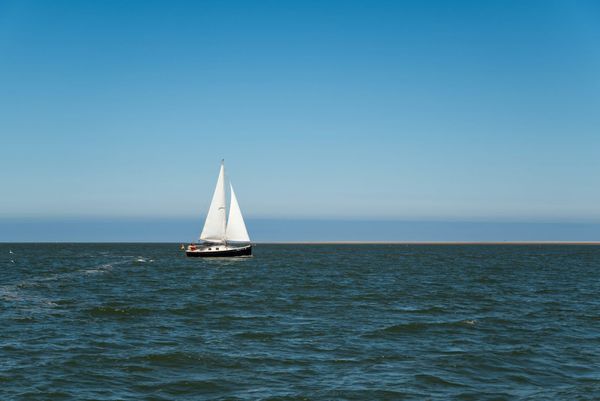
Canaries to Caribbean (November-January). The classic tradewind crossing. Depart the Canary Islands after late October, when the hurricane season in the Caribbean has effectively ended and the northeast trades are established. The route drops south to roughly 20°N to find consistent trades, then runs west to the Lesser Antilles — typically Barbados, Martinique, or St. Lucia. Distance: 2,700-3,000 nm. Duration: 14-21 days. This is the ARC (Atlantic Rally for Cruisers) route, sailed by hundreds of boats annually.
Caribbean season (December-May). The prime cruising window. Trade winds blow 15-25 knots from the east, the islands are dry and sunny, and hurricane risk is effectively zero. Most cruisers work their way north through the Lesser Antilles, explore the Leewards and Windwards, and position for departure by late May.
Caribbean to Azores/Europe (May-June). The return passage. Timing is critical: leave the Caribbean before hurricane season begins (June 1) and route northeast to the Azores, taking advantage of the westerlies that develop in the mid-Atlantic above 30°N. The passage involves crossing the Bermuda-Azores high — potentially several days of light winds in the horse latitudes — before picking up the westerlies for the final approach to the Azores. Distance: 2,000-2,400 nm. Duration: 14-21 days.
Azores to Northern Europe or Mediterranean (June-August). From the Azores, boats disperse: northwest to the UK and Ireland, northeast to Portugal and the Bay of Biscay, or southeast to Gibraltar and the Mediterranean. All routes are best sailed in the settled summer weather before the autumn gale season begins in September.
The Pacific Milk Run
The Pacific is the ultimate cruising ocean — vast distances, spectacular islands, and weather windows that define the annual rhythm of every boat in the basin.
Panama to Galapagos to Marquesas (February-April). The Pacific crossing begins with a southwestward passage from Panama to the Galapagos (800 nm, often a frustrating combination of calms and contrary currents in the ITCZ). From the Galapagos, the route runs west-southwest to the Marquesas in French Polynesia — 3,000 nm of predominantly downwind sailing in the southeast trades. This is one of the great ocean passages: 18-25 days of tradewind sailing, often in moderate conditions, with a spectacular landfall at Nuku Hiva or Hiva Oa.
Departure timing matters. Leave Panama too early (before February) and you hit the ITCZ at its worst. Leave too late (after April) and you risk arriving in the western Pacific too late to clear the cyclone belt before the season begins in November.
French Polynesia to Tonga/Fiji (May-August). The westward progression through the South Pacific follows the trades: Tuamotus, Society Islands (Tahiti, Bora Bora), Cook Islands, Tonga, Fiji. Each leg is 500-1,500 nm, sailed in the reliable southeast trades. The constraint is cyclone season: boats need to be west of 170°W by November to be out of the cyclone belt, or south of the belt in New Zealand.
Fiji/Tonga to New Zealand (October-November). The passage south to New Zealand is the most weather-dependent leg of the milk run. It crosses the convergence zone between the tropical and temperate weather systems, and timing the weather window is critical. A good window provides 5-7 days of manageable conditions for the 1,100 nm passage. A bad window delivers gale-force headwinds and dangerous cross seas. Most experienced cruisers watch the weather models for a week or more before committing.
New Zealand season (November-April). New Zealand offers spectacular cruising — the Bay of Islands, Marlborough Sounds, Fiordland — and excellent boatyards for maintenance. The cyclone belt is to the north, and New Zealand is generally safe (though ex-tropical cyclones occasionally track far enough south to affect the country).
The Indian Ocean
Southeast Asia to Indian Ocean (August-October). The passage from Southeast Asia (typically Malaysia or Thailand) across the Indian Ocean to Sri Lanka, the Maldives, or Chagos follows the transition between the southwest and northeast monsoons. Timing is everything: the southwest monsoon (May-September) produces adverse winds for a westward crossing, so most boats wait for the transition period or the early northeast monsoon.
Red Sea (December-March). The Red Sea is the most dreaded passage on a circumnavigation. Prevailing northwesterly winds blow directly against northbound boats for the entire 1,200 nm from Aden to Suez. Timing the passage for the seasonal wind breaks (typically December-February, when the southeast monsoon in the southern Red Sea provides favorable conditions for at least the first half) is essential. Buddy-boating and conservative weather routing help. Many cruisers spend 4-8 weeks working north, anchoring by day and motorsailing at night.
Mediterranean (April-October). The Med offers extraordinary cultural cruising but demanding sailing: strong seasonal winds (the Mistral, Meltemi, and Sirocco), crowded anchorages, and expensive marinas. The cruising season runs from April to October, with July-August being the busiest and windiest period.
The Circumnavigation Timeline
A typical westabout circumnavigation — the most common direction, following the trade winds — takes 3-5 years for a cruising couple who wants to explore rather than race. The major weather gates that define the schedule: