Eastbound Atlantic Crossings: Weather Routing Your Spring Passage to Europe
Everything you need to plan a safe and enjoyable Atlantic passage.
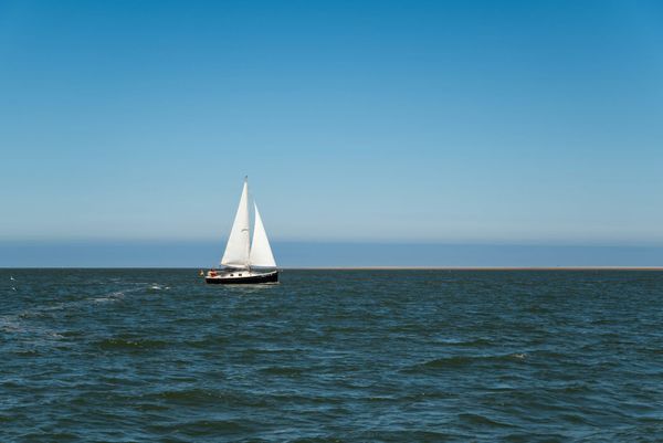
April is when the conversation shifts in every Caribbean anchorage. Hurricane season is two months out, the trades are starting to clock around, and the question on everyone's lips is the same: when do we leave? For boats heading east to Europe, the spring transatlantic passage is one of the great bluewater challenges — not because of its distance, but because of its weather complexity.
Unlike the westbound trade wind crossing, which is essentially a downwind sleigh ride, the eastbound passage demands real weather routing skill. Here's how to think about it.
Choosing Your Window: May Is the Sweet Spot
The conventional wisdom says May through mid-June for an eastbound departure, and conventional wisdom is right on this one. You're threading between two hazards: the tail end of North Atlantic winter storm activity and the early stirrings of hurricane season. April departures are possible but push you into a more active weather pattern, with late-season lows still tracking across your route. Wait until July and you're playing chicken with tropical systems.

A mid-May departure from Bermuda or the U.S. East Coast gives you the best statistical odds of settled weather across the basin. But statistics don't sail boats — forecasts do.
Understanding the North Atlantic Weather Machine
The Bermuda-Azores High is your best friend and your worst enemy on this passage. In spring, it's typically centered somewhere between Bermuda and the Azores, creating a clockwise circulation pattern. The southern edge gives you favorable westerlies for your easting, but stray too far into the center and you'll be wallowing in light airs for days.

Meanwhile, low-pressure systems continue to form off Cape Hatteras where warm Gulf Stream air collides with cold continental air masses. These lows track northeast across the Atlantic, and their associated cold fronts will cross your path. The key is not to avoid them entirely — that's nearly impossible — but to time your departure so you're not caught in the worst of the frontal passages.
The Three Classic Routes
The Northern Route (Great Circle) is the shortest distance but roughest ride. You're cutting close to the storm track and dealing with fog on the Grand Banks. Best for fast boats that can outrun weather systems or for later-season crossings when the storm track has retreated north.

The Azores Route is the most popular choice for cruising boats, and for good reason. You sail east-southeast from Bermuda or the East Coast to the Azores, picking up favorable winds on the southern side of the high. From the Azores, it's a relatively short hop to Portugal or the Mediterranean. This route adds miles but subtracts misery.
The Southern Route (Trade Wind) drops south to pick up the northeast trades and ride them east. This is the longest route by far and really only makes sense if you're departing from the Caribbean and want to avoid the North Atlantic entirely. You'll end up approaching Europe from the south, likely making landfall in the Canaries or Madeira.
Practical Weather Routing Tips
Use a professional weather router. This is not the passage to rely solely on your own GRIB file interpretation. Services like Chris Parker's Marine Weather Center, Commanders' Weather, or PredictWind's routing tools have extensive experience with this crossing and access to ensemble forecast models that give a much better picture of uncertainty than a single GFS or ECMWF run.

Study the 500mb charts. The upper-level pattern drives surface weather. A strong ridge in the upper atmosphere over the central Atlantic means the Bermuda High will be well-established and your route through the westerlies on its southern flank should be clear. A deep trough means active weather and you should wait.
Plan for 7-14 day weather windows. You don't need perfect weather for the entire crossing — you need a clean departure window that gets you well offshore before the next system moves through. Once you're 500 miles out, you have sea room to maneuver around systems.
Carry more fuel than you think. Light-air patches are common, especially near the center of the high. Having enough diesel for 400-500 miles of motoring means you can punch through calms without burning days of provisions and patience.
Check your rig before you go. This sounds obvious, but spring is when rigs fail. Boats that have spent a season in the Caribbean trades may have fatigue in standing rigging, chafe on running rigging, and UV damage to sails. A professional rig inspection before departure is cheap insurance against a mid-ocean dismasting.
Final Thought
The eastbound Atlantic crossing rewards patience and preparation above all else. The sailors who have the best passages are invariably the ones who waited for the right window rather than leaving on a schedule. Your insurance company doesn't care about your Mediterranean charter booking. Leave when the weather says go, not when your calendar does.